
Read a Midlothian Neighbor Block
Start with a defined relationship to one address. Midlothian neighbors can be explored as a parcel touching the subject tract, a parcel across a public right-of-way, or another parcel on the same block face. ECAD then supplies the assessment owner and parcel fields for each identified tract. Association certificates and city event pages describe a community layer, not a membership roster. Keeping those categories apart makes a neighbor search more accurate and less intrusive.
| Source | What it shows about a block | Access |
|---|---|---|
| Ellis County GIS | Parcel boundaries, roads, address context, and published map layers | Free public portal; layer dates vary |
| ECAD property search | Assessment owner, mailing and situs fields, legal description, parcel identifiers | Current public property search |
| Ellis County deed index | Dated ownership instruments for a selected parcel | Free index; image access differs |
| Texas voter tools | Limited individual registration status and jurisdiction context | Protected fields withheld; no block map |
| HOA certificates and civic pages | Association or participating-community names and contact routes | Public documents or voluntary public pages |
An ECAD owner is an assessment and property clue, not proof that the named owner currently lives at the situs. A mailing string can point to an entity, agent, family member, or another location. Likewise, a blank name on a map is not evidence that a parcel has no owner. Note: Save the subject parcel, adjacent parcel, relationship, source, and retrieval date before adding any historical record.
A Midlothian block can cross city limits, the ETJ, or unincorporated Ellis County while keeping one street name. In that setting, city GIS, county GIS, ECAD, and the County Clerk can each hold a different part of the evidence. Label the custodian for every map, parcel field, and instrument instead of assuming a city name settles the record boundary. Preserve that custodian field for later verification.
Map Parcels Around Midlothian Neighbors
The adjacent-parcel method begins with the subject address in county or city GIS. Use the available parcel and road layers, click the subject tract, and record its legal or geographic identifier. Then identify each parcel that shares a boundary or fronts the same block. The research did not confirm a live buffer or rectangle-selection tool, so a click-and-identify workflow is the supported method rather than an assumed radius search.
- Find the address in the Ellis County GIS portal and record the subject parcel key.
- Click the boundary-sharing or same-block parcels and label the relationship shown by the map.
- Search each selected property ID or situs in ECAD, preserving the difference between assessment owner, mailing address, and situs.
- Use the deed index only when a selected parcel needs ownership-history context, then match the legal description before saving the instrument.
- Move to the Midlothian street directory only when the question expands from the immediate block to a full named-street record chain.
The Ellis County GIS portal landing page is the source for the web-map entry point and address resources.
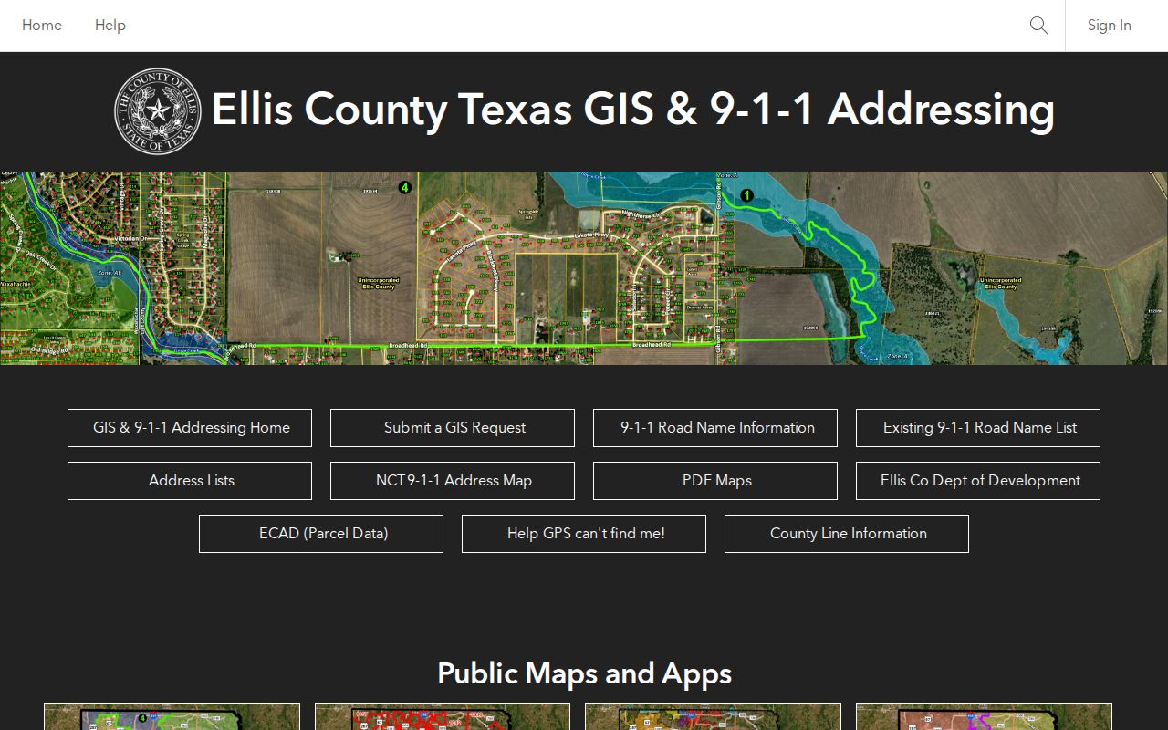
Use the parcel key to keep the map, ECAD result, and any selected instrument connected to the same tract.
Separate Midlothian Neighbor Relationships
“Neighbor” needs a label before any record is collected. A shared-boundary parcel and a parcel across a public right-of-way are geographic relationships shown by GIS. A same-block address is a street relationship. An HOA or civic association is a community relationship, while National Night Out participation is an event relationship. None automatically identifies a household or proves that every nearby address belongs to the same subdivision.
| Relationship label | Best supporting source |
|---|---|
| Shares a boundary | Parcel layer and a map retrieval date |
| Across the street | Road layer plus parcel locations |
| Same block face | Address sequence and map context |
| Association area | HOA management certificate or voluntary public association material |
| Event participant | Dated city civic-event list |
For a common-area tract, road, utility tract, or parcel that lacks an accessible owner result, record the condition as blank or unavailable. It is more accurate than converting a missing display field into a claim about a person.
Limit Midlothian Neighbor Voter Data
The Texas Am I Registered? lookup is designed around an individual’s current status, not a public map of a block. A result can return registration and jurisdiction context after the live form’s identity prompts. It does not reveal ballot choices, because ballots are secret, and Texas voter registration is not organized by political party.
A statewide voter-file request is different from the lookup screen. The SOS request process has certification and use terms, with protections for Social Security numbers, driver-license or personal-ID information, dates of birth, telephone numbers, and protected addresses. Texas Address Confidentiality Program participants can be excluded or represented through substitute-address rules. Do not infer Midlothian neighbors from a lookup screen or publish names at nearby homes. Note: A non-match may result from spelling, a move, status maintenance, protection, or a different county.
Use Midlothian HOA Contact Records
The Texas HOA management-certificate search is the official route for confirming an association and available management-certificate document. Its filters include association, county, city, ZIP, and type. The documented Midlothian results establish association names and a contact or management path, not a directory of members.
| Community or association named in research | Public record context | Boundary to retain |
|---|---|---|
| Midlothian Arbors HOA; Kensington Park North HOA | State certificate-search association results | Association identity, not resident membership |
| Village at Midtowne Community Association; Village at Midtowne Townhome Association | State certificate-search association results | Contact or document route only |
| Coventry Crossing HOA; Autumn Run HOA; Eagles Nest POA | State certificate-search association results | Do not infer coverage of every parcel |
| West Highland Estates HOA; Dustin Manor HOA | State certificate-search association results | Do not imply access to private materials |
| Spring Creek Estates HOA | Public contact route; some documents require registration | Restricted materials are not a public roster |
Association websites and board packets may be registration-gated. For Midlothian neighbors, a public contact route or management certificate can answer whether an association exists without turning voluntary community records into a block directory. The city’s public National Night Out listings can add a dated civic layer, but those listings do not define HOA boundaries or membership.
Place Midlothian Neighbors in Event Context
The city’s Midlothian National Night Out page supplies a civic context that differs from parcel research. Its documented 2025 participant list includes neighborhood names such as Autumn Run, Dove Creek, Brandi Ridge, Azalea Hollow, Ridgepoint, Lawson Farms, The Grove, Fox Run, Spring Creek Estates, Coventry Crossing, and Westside Preserve. A dated event list shows participation context only. It does not establish that every household in a named area attended or belongs to an association.
The Midlothian National Night Out page also carries the city’s 2026 kickoff information and is the source to recheck for current event details.
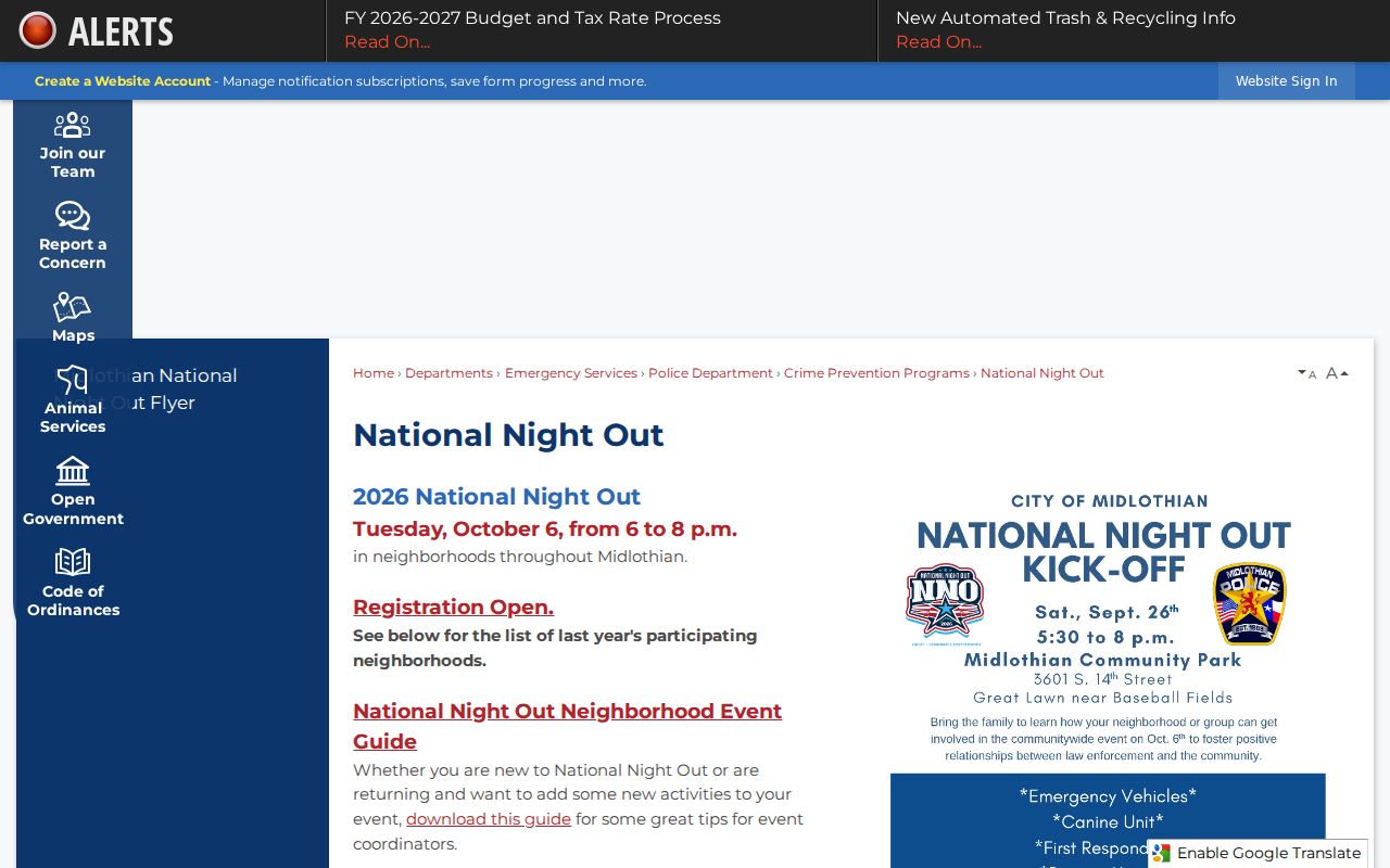
Use a community-event name as a search and contact lead, not as evidence about individual residents.
Compare Midlothian Neighbor Sources
Official parcel, deed, association, and civic sources put a record under a named custodian and make its limits easier to check. Commercial neighbor-lookup products combine public and brokered fragments. They can assign the wrong person to an address, retain stale data, and omit protected residents. A claimed connection between Midlothian neighbors is best verified against the specific official record that matches the question.
| Official source category | Commercial neighbor category | Practical check |
|---|---|---|
| Parcel, deed, HOA certificate, or city event record | Compiled public and brokered fragments | Identify the custodian, record date, and field label |
| Shows a defined property, instrument, association, or event relationship | May merge identities or retain old address links | Do not treat an address association as a current household fact |
For a deed question, consult the County Clerk index. For a map question, consult GIS. For an association question, use a certificate or public contact route. That narrow match reduces unnecessary collection of personal information.
Protect Midlothian Neighbor Privacy
A parcel map, owner record, association name, or dated event mention does not expose all information around a block. Midlothian neighbors who live at a property but are not named in a public record, utility customers, delivery records, DMV personal data, sealed records, and protected address information are not proper subjects for a neighbor lookup. An absence from a result can be an intentional safeguard rather than a gap to work around.
The Texas Address Confidentiality Program provides a substitute-address process for eligible survivors. Texas voter rules also protect confidential voter information. If an instrument appears to contain a sensitive identifier, quote the parcel, instrument, or case reference to the custodian and ask about the applicable redaction route rather than republishing the information.
Lawful use. Use Midlothian neighbor records for personal, civic, genealogy, or property-history questions. Do not use records to watch, harass, intimidate, or harm anyone.
Request Midlothian Block Records Carefully
When the map does not expose the needed record, ask the actual custodian for an existing, narrowly described item. A city request can name the address, record type, and date range for a permit, map layer, or municipal document. The Texas Public Information Act provides access to existing government information, but it does not require an agency to create a block list or solve a research question.
Start with the city or county office that holds the record: GIS for map or addressing context, ECAD for a current appraisal field, the County Clerk for a recorded instrument, and an association’s public contact route for its own documents. The city address process uses the ECAD parcel ID and primary-access road, so those two fields make a focused GIS or permit request more reliable. Preserve a response date and the office named in the reply. Note: A focused request protects both accuracy and privacy by limiting the records sought to the actual question.