
Midlothian ZIP Code Coverage
The primary delivery ZIP for Midlothian is 76065. Census profile geography also shows Midlothian city intersecting the 75167 and 76084 ZCTAs. Those are not three interchangeable USPS assignments. A delivery ZIP can run beyond city limits, while a Census ZCTA is a statistical approximation. Use the table as a verification starting point, then let the USPS result for the precise address settle the delivery line.
| ZIP | Areas Covered | Post Office | Notes |
|---|---|---|---|
| 76065 | Primary Midlothian delivery area, including the incorporated core and surrounding delivery area | Midlothian Post Office | Confirm the exact street with USPS; the ZIP can extend beyond city limits. |
| 75167 | Census ZCTA intersection with Midlothian city statistical geography and the regional Waxahachie/Midlothian area | USPS address lookup required | Do not label every address as Midlothian without a USPS result. |
| 76084 | Census ZCTA intersection with Midlothian city or edge geography | USPS address lookup required | A statistical overlap is not proof of a delivery assignment. |
The Midlothian Post Office is at 211 E. Avenue G, Midlothian, Texas 76065-3039. Its listed retail hours are Monday through Friday from 8:00 a.m. to 4:30 p.m., Saturday from 10:00 a.m. to noon, and closed Sunday. The official source notes carrier, general-delivery, and PO Box services, with some other services unavailable there. No official source located a Midlothian ZIP realignment year, PO-box-only ZIP, or unique-institution ZIP, so none should be assumed.
Verify a Midlothian Delivery ZIP
The USPS lookup is the delivery authority for a specific address. It offers By Address, By City & State, and Cities by ZIP modes. The address mode can return several choices, and USPS warns that a result does not confirm a person or company at the address. Select the more specific result when several lines are returned, then record it as a postal result rather than a statement about city jurisdiction.
The official USPS lookup displays the three search paths used to verify a Midlothian delivery line.
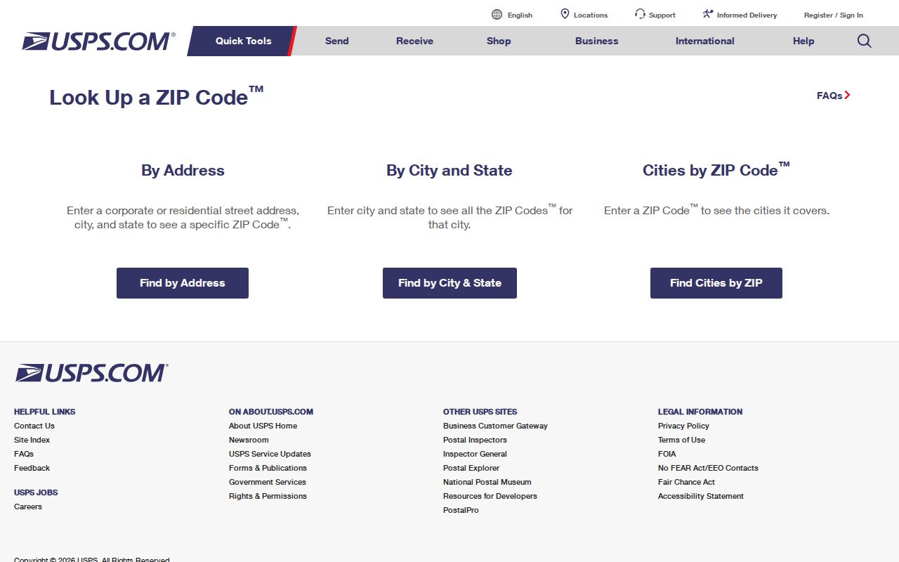
A city-and-state search is useful when the street is not yet known, but an address result is the stronger postal confirmation for a parcel or correspondence line.
| USPS field or mode | Type | Required | Use |
|---|---|---|---|
| By Address | Search mode | Street address | Returns a delivery ZIP for a supplied address. |
| Company | Text | No | Optional address detail; it does not prove who is present there. |
| Apt/Suite/Other | Text | No | Optional unit detail for a more specific delivery search. |
| By City & State | Search mode | City and state | Provides a city-level postal starting point. |
| Cities by ZIP | Search mode | ZIP | Checks postal city associations for the supplied code. |
Midlothian ZCTA Intersection Myth
A ZCTA is the Census Bureau's statistical approximation of ZIP service geography. It helps describe an area in Census context, but it does not promise that every local address shares one mailing city or ZIP. That is why 75167 and 76084 appear in Midlothian's Census profile even though 76065 is the primary Midlothian delivery ZIP. Present each result with its source label instead of flattening a Census intersection into a USPS claim.
A useful record note might say “USPS ZIP returned for this address,” “Census ZCTA intersects Midlothian,” “ECAD situs city,” or “city GIS/ETJ.” These labels preserve the difference between delivery geography, a government boundary, and a statistical area. They also prevent a map filter from becoming a claim about a specific resident.
Note: Census ZCTA intersections are valuable for statistical context, but USPS must verify the delivery ZIP for a particular address.
Find Residents by Midlothian ZIP
A ZIP narrows geography, not a public list of people. Begin with a known address or parcel and verify its delivery ZIP first. The official research did not establish that current ECAD or GIS searches accept a ZIP-wide filter, so do not rely on an assumed search control. The public Texas voter lookup is a current-status tool and does not serve as a ZIP-wide resident roll. Where a portal offers a ZIP field, confirm its live behavior and document what the result actually represents.
- Enter the full known address in USPS By Address and save the returned ZIP and the date checked.
- Compare that line with the ECAD situs field and the parcel's property or geographic ID. Do not substitute a mailing address for a situs address.
- Open the county or city map for the parcel, then identify whether the location is city, ETJ, or unincorporated geography.
- Use only the narrow public record needed for the question. Record the source label, retrieval date, and any result limitation.
Once a verified ZIP leads to a specific street or parcel, the Midlothian street address directory has the address-keyed workflow for ECAD, GIS, and recorded documents. Do not use a ZIP alone to infer every occupant of an area.
Midlothian Address Record Keys
Postal ZIP, ECAD parcel keys, and deed identifiers answer different questions. A property ID is a local assessment account key. A geographic ID identifies appraisal geography. A subdivision, lot, and block describe platted land, while an abstract, survey, or metes-and-bounds description can identify older or rural land. An instrument number identifies a recorded document. None of these should be swapped for another when checking a Midlothian address.
ECAD can display a current assessment owner, situs address, mailing address, legal description, and appraisal context. A mailing address may be a useful contact-location lead, but it is not proof of residence. The County Clerk's recorded document index can connect a legal description to a dated transfer. USPS then standardizes the delivery line as a separate step.
Midlothian's address-request process shows why these fields should not be collapsed. The city form uses a six-digit ECAD parcel ID and a primary-access road for new, changed, verified, or unit addresses; it can also collect subdivision, lot, block, and site-plan information. A parcel key supports local addressing work, while the legal description supports a deed search and USPS verifies the final delivery line. Each field should retain its own source label and retrieval date.
- ZIP versus ZIP+4
- A ZIP identifies a broad delivery area; ZIP+4 adds a more precise delivery segment.
- PO Box ZIP
- A ZIP assigned for post-office boxes rather than proof of a street-delivery area.
- Unique ZIP
- A ZIP used for one qualifying organization or institution; no Midlothian example was located in the research.
- Carrier route
- The route used to organize mail delivery, not a city boundary or resident roster.
Midlothian GIS Address Authority
Address assignment is an office-geography question. Midlothian Maps and GIS assigns addresses inside the city and ETJ and publishes public maps through the city's Geo Hub. Ellis County GIS and 9-1-1 Addressing coordinates county geospatial data. For unincorporated areas and the Midlothian ETJ, the county describes coordination with Development Services while the city handles city and ETJ functions. A city label, parcel map, and postal ZIP can therefore be accurate at the same time without meaning the same thing.
The official Midlothian Maps and GIS page identifies the city's Geo Hub and public map resources.
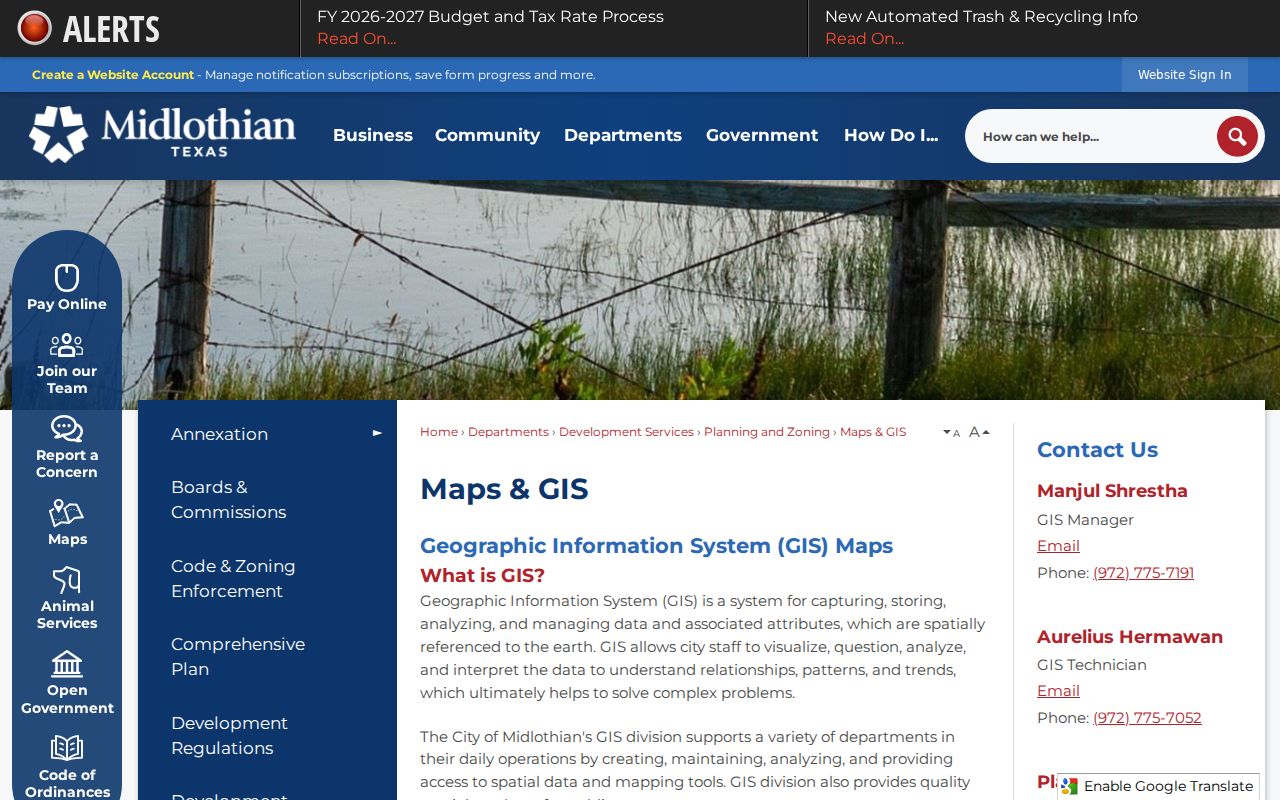
When a desired map layer is not online, the city directs requesters to its public-information process. The address-request form also ties a new, changed, verified, or unit address to the six-digit ECAD parcel ID and primary-access road.
Midlothian Portal Search Limits
Official tools use ZIP fields for different purposes. USPS is designed to verify a delivery line. The Texas HOA management-certificate search visibly supports association name, county, city, ZIP, and type filters, but its public purpose is current certificate and management contact information, not a membership roster. An association name can describe a subdivision or an event area without matching a USPS city, a county precinct, or every parcel in the area.
ECAD and GIS are useful after a parcel or address is known, yet the research did not reliably capture their current ZIP-filter behavior. Check the live portal before claiming that it returns every parcel in a ZIP or supports an exact ZIP search. The Texas SOS registration lookup is likewise a status tool rather than a ZIP-wide public roll. City permits, code cases, service-district maps, and school-zone tools can add address geography, but they do not identify every person associated with that geography.
Utility customer lists are not a public resident directory. Keep a ZIP search limited to the record needed for a stated, lawful personal, civic, family-history, or property-history question.
Midlothian Boundary Lookup Limits
ZIP boundaries do not trace Midlothian city limits. An address may have Midlothian in a mailing field, sit within city limits on GIS, fall in the ETJ for planning, or receive a different USPS city name. The correct result depends on the question. Use USPS for delivery, city GIS for city or ETJ addressing, ECAD for the appraisal situs, and the County Clerk for a recorded legal description. A new address can depend on its parcel ID, primary-access road, and plat before USPS assigns the final delivery line.
Boundary check. Do not treat a ZIP-wide result as a resident list. Keep the source label and verify each exact address with USPS before relying on a delivery ZIP.
Document Midlothian ZIP Results
A clean Midlothian ZIP search note lists the full address searched, the source used, the ZIP returned, the parcel or legal key if relevant, and the date retrieved. Add whether the result came from USPS, ECAD, county GIS, city GIS, or Census geography. That small record preserves the distinction needed when a subdivision spans jurisdictions or an older deed has an address format that predates a current delivery line.
Historic searches may also need Barker, Ellis County, Waxahachie, railroad, or post-office terms because those references can precede formal city incorporation or a modern address. Those terms are historical search anchors, not substitutes for a verified current ZIP.